Flooding Missions Continue from Canadian Border to Gulf of Mexico
Paul South
Contributing Writer
As the heavy rains, severe storms and rising floodwaters spilled southward, from spring into summer and from the Canadian border to the Gulf of Mexico, Civil Air Patrol squadrons continued their labors in the air and on the ground.
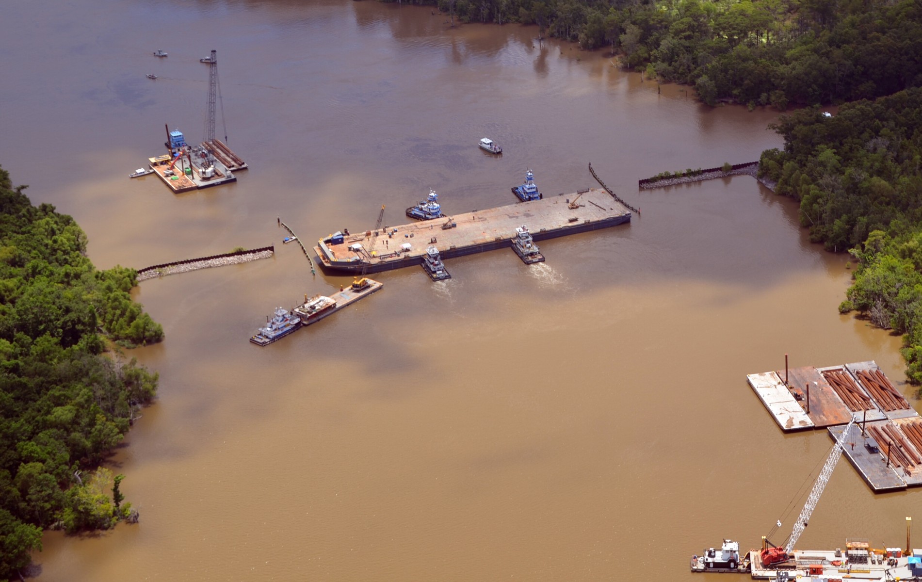
The all-volunteer force stuffed sandbags, took aerial damage assessment photos and provided other ground support. In St. Mary Parish, Louisiana, CAP crews assisted in the sinking of a barge to fend off slowly rising waters.
And in Kansas, CAP transported much-needed plastic sheeting from Oklahoma after supplies dwindled in the Sunflower State. That was just part of the overall CAP mission.
Lt. Col. Paul Rappmundt of the Louisiana Wing has been here before. For nearly three decades he has served as a CAP incident commander, assisting state and local emergency management officials and the U.S. Army Corps of Engineers in the wake of natural disasters. He’s a 27-year veteran of CAP.
 “The difference between the flooding events that we’ve got with this stuff and the hurricanes, catastrophic events like Katrina (2005) and Camille in 1969, we’ve got a lot more warning,” Rappmundt said. “We can actually plan a little bit ahead of time.”
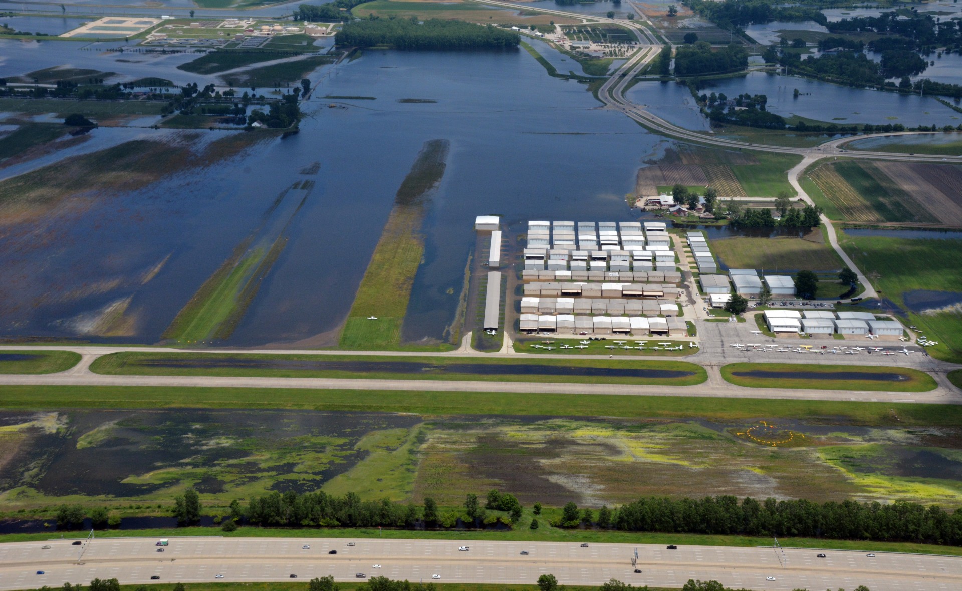
CAP aerial imagery helps emergency officials change their response on the fly if need be. The Louisiana Wing collected some 800 photos in 10 sorties.
The images came from St. Mary, Iberia, Terrebonne, Assumption, St. Martin, Avoyelles, Rapides, Point Coupee, Iberville and St. Landry parishes.
CAP pilots in Baton Rouge, Alexandria and Shreveport also gathered aerial data, helping areas like Caldwell Parish, where 39 roads were flooded. Images also came from Catahoula Parish. In essence, Civil Air Patrol squadrons covered the entire state.
“The pictures we take to assist GOHSEP (Governor’s Office of Homeland Security and Emergency Preparedness) and their emergency planning (to tell them) if they need to reposition their emergency planning, that’s what we do,” Rappmundt said. “We give them the opportunity to sit down and say, ‘We need to position this equipment in these areas to help these people.’
“In a hurricane, there’s no real telling exactly what’s going to happen because you don’t know where it’s going to make landfall,” he added.
While the Louisiana Wing mission focused on aerial photos, it also involved a barge sinking in Bayou Chene, 9 miles southeast of Morgan City. The bayou connects to the Atchafalaya River, which flows through the heart of Cajun Country and into the Gulf of Mexico.
When the Atchafalaya floods, waters wash back up into Bayou Chene and into the backside of Morgan City, and also into Stephensville, Belle River, Pierre Part, Plaquemines and areas outside flood protection levees, endangering those communities.
The sunken Bayou Chene barge, 300 feet long by 75 feet wide, acts much like a set of locks in a dam. It keeps waters down near Morgan City and the surrounding communities impacted by the Lake Verret Watershed. Neighborhoods still flooded, but the barge made a difference. It was the third such structure submerged in the area over the years.
“If it hadn’t been for that barge, it would have been much worse,” Rappmundt said. “It would have flooded Stephensville, Pierre Part, Belle River and probably gone all the way up into the western part of Plaquemines, any of the area that feeds into Lake Verret from Morgan City almost to Baton Rouge. You’re talking about a tremendous area.”
CAP gathered photographs before, during and after the installation of the barge. The entire operation took six to seven days.
Meanwhile, CAP squadrons elsewhere took to the air and to the ground in the latest spate of flooding.
Col. Regena Aye, North Central Region commander, offered a rundown of wing activity, including sandbagging, photo flights and emergency operational support:
 The Kansas Wing provided support in the state emergency operations center, filled some 8,000-10,000 sandbags over two days, generated 45,000 photos and flew 44 hours. In addition, the wing provided aerial damage assessment after an EF 4 tornado roared through the state.
So severe was the damage, plastic sheeting quickly vanished from store shelves. “There was no plastic sheeting to  be found in the state of Kansas,” Aye said. “So we transported sheeting from Oklahoma, so the Corps of Engineers could use that for a dam that was compromised.”
CAP’s Southwest Region assisted in that effort, Aye said — an example of regional cooperation.
In all, the Kansas Wing executed 32 aerial missions. The mission continues for members in Kansas, where 67 counties were designated as state disaster areas, while 33 were included in a federal disaster declaration.
The Minnesota Wing took photos along the Minnesota and Mississippi rivers near Minneapolis-St. Paul, flying six sorties and 10.8 hours. The mission also served as an evaluation exercise for the wing.
Nebraska Wing aircrews flew sorties to assist Iowa Homeland Security in Pottawattamie County, Iowa, while the Iowa Wing supported Air National Guard training in Wisconsin. “Good collaboration and teamwork,” Aye said. It’s an example of neighbor helping neighbor.
The Missouri Wing gathered aerial images as well. In the midst of these weather events, the wing was also involved in an exercise to prepare in the event of an earthquake on the New Madrid Fault Line. Earthquakes in the seismic zone potentially impact Missouri, Indiana, Illinois, Arkansas, Kentucky, Tennessee, Oklahoma and Mississippi. The Missouri Wing also responded in the wake of a twister that struck Joplin and Jefferson City in Missouri.
With the surge in the number of weather events across the country, a key lesson has been learned, Aye said: Razor-sharp training, readiness and cooperation are critical.
“What we train for, you hope you never have to put into practice,” she said. “But unfortunately (catastrophic events) happen. So that training pays off when you accomplish the mission.
She added, “Our collaboration and partnerships with various entities that respond in the wake of disasters, the importance of those come out in these types of disasters — the relationships with the states, your relationships with the border wings and other regions are critical.
“When these things hit, they never seem to hit in one place. That puts additional stress on the system, but it emphasizes how important it is that we work together and that we be able to support each other when it does happen,” Aye said.
In an interview with Arkansas Educational Television Network station KTEJ-TV in Jonesboro, A.J. Gary, the state’s director of emergency management, highlighted that cooperation and the work of Civil Air Patrol aerial imaging and the state’s GIS office, the Arkansas National Guard and the Army Corps of Engineers. CAP helped the state map the flood-ravaged Arkansas River and provided communities like Dardanelle and Jonesboro with aerial photography, he said.
 “This is some great stuff we can use from now on, because we can look at that computer screen and we can see what the river looked like before the flooding and we can see the impact after the flooding,” Gary said. “It’s been a great tool to find those houses that are impacted, so we can get the assessment teams into them.”
In an economic sense, the storms of 2019 illustrate another example of CAP effectiveness.
“We’re the biggest force multiplier that’s available,” Rappmundt said. “The actual cost per hour, including aircraft, is $15-$18 an hour for the labor, equipment and all the things we provide. That would be the best value for the taxpayer.”
“I think that’s the biggest selling point,” he said, “the bang for the buck the taxpayers get from Civil Air Patrol and its volunteers. The guys are really doing a professional job.”
As the end of June approaches, more heavy rains and storms are expected in the Midwest.
Down south in Louisiana, like the rest of the country in this season of wild weather when more flooding is possible, CAP pilots watch and wait.
“We’re kind of on hold right now, just kind of a wait-and-see attitude,” Rappmundt said. “The door is still open.”


