Puerto Rico Wing, CAP Colleagues Respond to Flooding from Fiona

 Puerto Rico Wing members and their CIvil Air Patrol colleagues from three other wings are responding in the air and on the ground to catastrophic flooding caused by Hurricane Fiona.
Members are flying damage assessment photography missions over affected areas, including structures such as roads and bridges, power plants, schools, and hospitals. The images they provide help emergency management agencies decide where damage is most severe and resources are most needed.
“These difficult times reminded us of the lessons from Hurricane Maria,” said Lt. Col. Carlos M. Arroyo, CAP incident commander, referring to the September 2017 storm that devastated the island. “From what we learned, and the training acquired, the Puerto Rico Wing and fellow CAP members improved our response time and use of top-end technology.”
About 55 CAP members have participated in the disaster response so far, representing not only the Puerto Rico Wing but also Connecticut, Missouri, Tennessee, and CAP National Headquarters at Maxwell Air Force Base, Alabama.
CAP has carried out 26 flights totaling 26.9 hours, with aircrews accounting for 17.6 hours and sUAS teams for 9.3 hours, The aerial missions have generated 10,339 images.
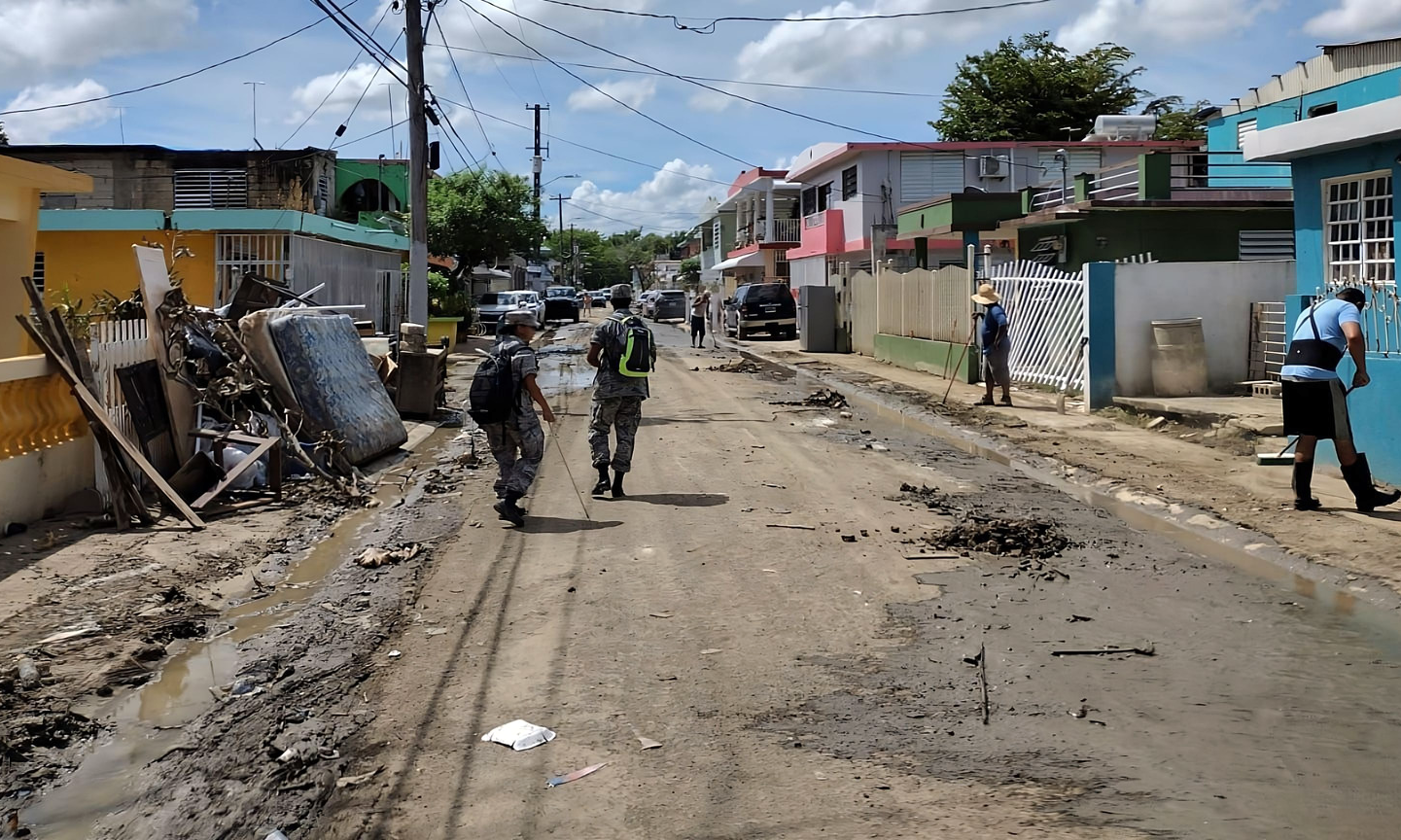
Ground teams have conducted 74 missions and produced 333 high-water-mark reports.
 “Our hearts go out to the people of Puerto Rico as many endure harsh conditions,” said Brig. Gen. Richard Dickens, vice commander, First Air Force, Air Forces Northern. “The Air Force auxiliary, Civil Air Patrol, continues to respond to civil support requests with the utmost urgency as part of the larger team of responders.”
Civil Air Patrol planes launched Sept. 20 in the community of Caguas, followed by two ground teams documenting high-water levels from recent flooding there and at Cayey.
CAP aircrews have also flown damage assessment photography missions over Puerto Rico Highway 802 around Corozal.

A Civil Air Patrol team using a small Unmanned Aircraft System (sUAS), or drone, photographed a damaged bridge in Jayuya, site of flash flooding, and two other sUAS teams captured images of railroad tracks from Bayamon Station to Sagrado Corazon Station at San Juan. Other sUAS flights occurred over repeater antennas in the mountainous central area of Puerto Rico and Hormigueros.
Along with additional photography flights over Caguas, Añasco, Salinas, and Ponce, ground teams conducted high-water-mark measurement missions in the Caguas, Cayey, and rainfall-battered Mayaguez areas. More ground missions are planned at Juana Diaz, Mayaguez, Cabo Rojo, San German, and Guayanilla.
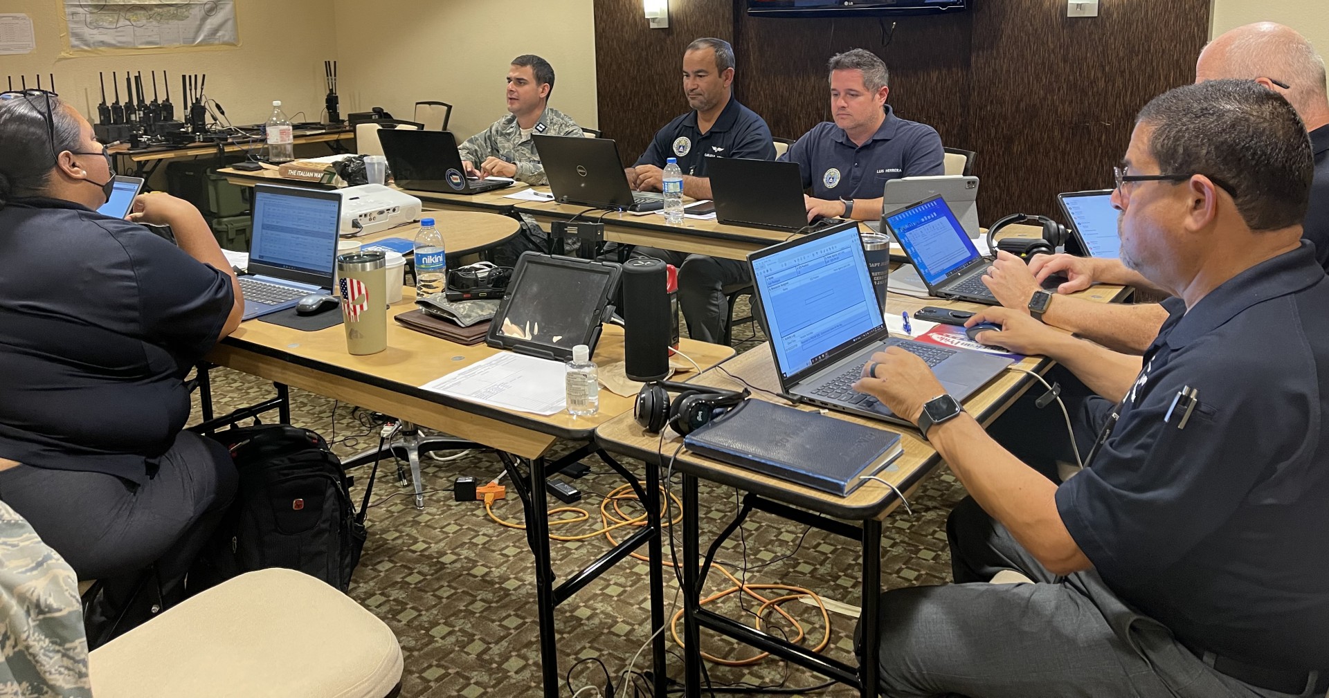
With most of the island lacking electricity and water, the Puerto Rico Wing has established a temporary incident command post in the municipality of Carolina with stable communications, including phone lines and internet access. The wing is maintaining 24-hour contact with other CAP Southeast Region wings – Alabama, Florida, Georgia, Mississippi, and Tennessee – and National Headquarters.

“The Puerto Rico Wing, Southeast Region and our CAP colleagues from other regions and wings continue demonstrating their commitment to volunteer service during new challenges,” said Col. Edgardo Torres, Puerto Rico Wing commander. “They have exceeded every expectation, and their level of teamwork is unprecedented. We as leaders are proud of their effort and selflessness in helping the people of Puerto Rico to overcome this disaster.”
Acting as a Total Force partner and official civilian auxiliary of the U.S. Air Force, Civil Air Patrol helps First Air Force rapidly respond to nonmilitary threats domestically in a Defense Support of Civil Authorities capacity to save lives, relieve suffering, prevent property damage, and provide humanitarian assistance.
_____
Capt. Elias Roman
Public Affairs Officer
Puerto Rico Wing


