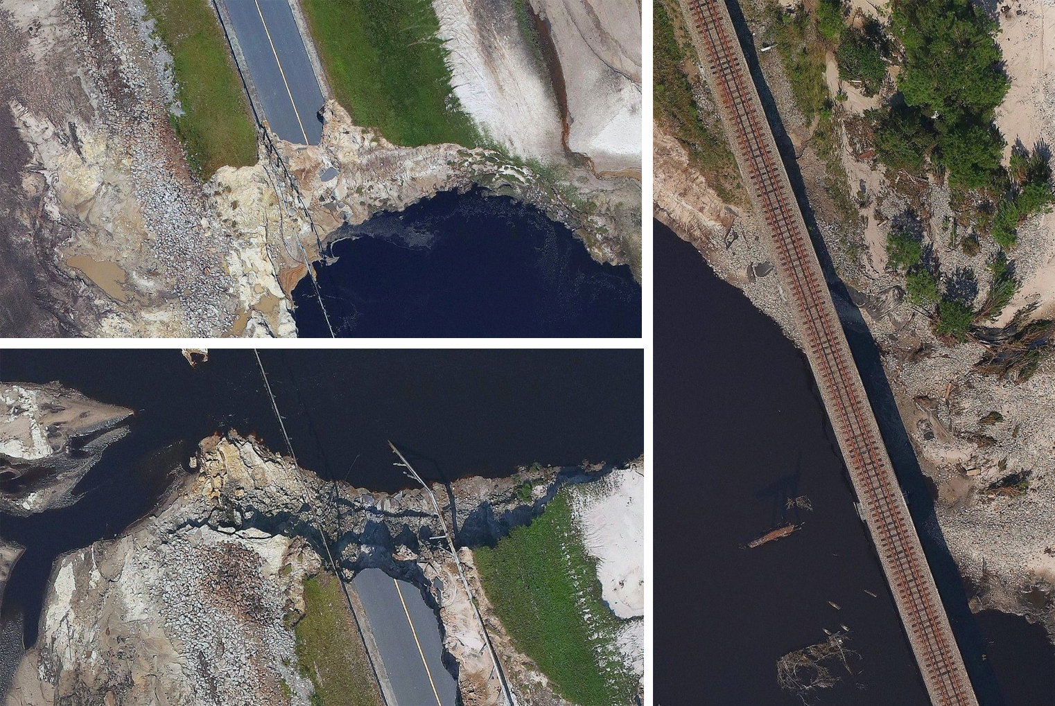
Specially Equipped CAP Planes Conducting Florence Damage Assessment Flights
Civil Air Patrol is in full launch mode this week in the Carolinas, with aircrews in both states conducting aerial imagery flights with specially equipped planes in support of the Federal Emergency Management Agency.
CAP, acting as the U.S. Air Force Auxiliary, is supporting Air Forces Northern (AFNORTH) during Defense Support of Civil Authorities operations following the landfall of Hurricane Florence on the East Coast. AFNORTH’s primary role is to support U.S. Northern Command’s efforts to provide assistance to FEMA's relief efforts.
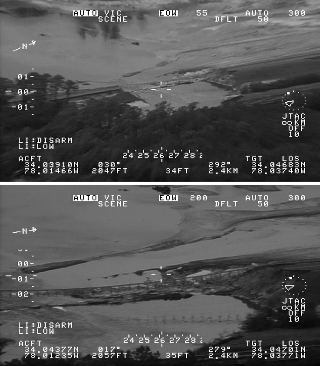
Surrogate Predator video
As part of that mission, CAP has launched a Surrogate Predator plane, or Surrogate Remote Piloted Aircraft (RPA), that can record video for review upon landing. The plane is flying sorties in South Carolina, complementing the more traditional Garmin VIRB and Nikon handheld camera imagery collection sorties that are also being flown.
“During this mission, our primary purpose is to support FEMA and its mission taskings,” said Lt. Col. Steve Wood, deputy commander of CAP’s Green Flag East Flight, which is based in Alexandria, Louisiana.
The Surrogate RPA, flown from its Louisiana operations base, was deployed in South Carolina to identify critical flooding issues along the upstate Lynches and Black rivers, where Florence dumped more than 30 inches of rain over the past weekend.
The aircrew flying the Surrogate RPA used the plane’s limited near real-time capability to report critical findings to supporting ground forces. They also delivered to federal and state emergency managers post-flight recordings of full-color, high-quality video taken during their flights documenting debris collection along the rivers and recording water levels as the rivers reach flood stage.
The aircrew also flew over the Intracoastal Waterway from Georgetown, South Carolina, into North Carolina. The crew recorded information concerning bridges, a lake dam and the water around these structures, which had risen significantly as a result of Florence.
CAP’s Surrogate RPAs — retrofitted with the same camera pod and controls used on unmanned aerial vehicles, such as MQ-1 Predators or MQ-9 Reapers — are typically deployed during U.S. military exercises to train troops for air-land integration combat before they deploy overseas. In a typical training exercise with a U.S. Army brigade, the full-motion video from the Surrogate RPA is live-streamed for simulation and instant decisions on the ground. In its use with FEMA and the response to Hurricane Florence, however, the crew videos the intended targets, then uploads video and extracted still photographs to the Domestic Operations Awareness and Assessment Response Tool Suite system.
Maj. Al Spain, commander of the Green Flag East Flight, said the cameras attached to the Surrogate RPA have infrared capability and can be used at night or when the cloud cover makes visual inspection of the targets difficult. He added that while the crew typically flies at 10,000 feet, the FEMA mission is being carried out around 1,500-2,000 feet.

WaldoAir camera systems
In addition to the Surrogate RPA, two other specially equipped CAP planes — carrying advanced WaldoAir camera systems capable of providing a multi-spectral view of the ground — are being flown from the North Carolina Wing incident command post in Burlington, surveying heavily flooded areas of the Tar Heel State. So far, those planes have flown nine sorties totaling 16.7 flight hours, collecting roughly 27,000 images..
Aircrews from the Tennessee Wing are testing the new aerial imaging system, which officials say is producing 3-D, 360-degree views over areas damaged by Florence.
Col. Dent Young, Tennessee Wing commander, said the camera pods, developed by WaldoAir and on loan from the Franklin, Tennessee, company, have been installed on two of CAP’s Cessna 182-T planes.
Young said the pods “are collecting high-resolution imagery of areas identified by the Federal Emergency Management Agency to evaluate both the capabilities of the camera system and the extent of the damage to selected areas.”
The pods, Young said, collect images that can be uploaded as individual photos “as well as being processed into three-dimensional, 360-degree views that permit very detailed analysis of any damage.”
WaldoAir describes its system as an “ideal, low-cost imaging solution for agriculture, city planning, pipeline and corridor monitoring along with many other GIS image collections.”
The system, which it markets as XCAM, provides “large-area coverage with up to 17,100 pixels in cross range, while using small, single-engine aircraft,” the company said on its website.
Mission pilot Lt. Col. Ande Boyer, one of 16 ground crew and four aircrew members deployed from the Tennessee Wing for the Florence response, described the WaldoAir system as “the highest-quality and most user-friendly total package imaging and image-processing system that I’ve ever seen.”
The enhancements “make sortie planning and execution a piece of cake,” said Boyer, who serves as the Tennessee Wing’s director of finance.
And, Young added, the system’s thermal options “greatly expand our time envelope by permitting night air searches.”
Satellite imagery
CAP aircrews have been flying multiple sorties in the Carolinas since Monday, providing damage assessment imagery and other emergency service missions, such as transportation flights, for FEMA as well as emergency management agencies in both states.
Incident commanders in CAP‘s Middle East Region are keeping up with the flights through a CAP National Radar Analysis Team system that takes a fusion of radar data and Automatic Dependent Surveillance-Broadcast (ADS-B) data and creates live plane tracks on a Google Earth map through satellite imagery. This imagery is displayed at incident command posts and other agency command posts where rescue and recovery air assets need to be tracked.


